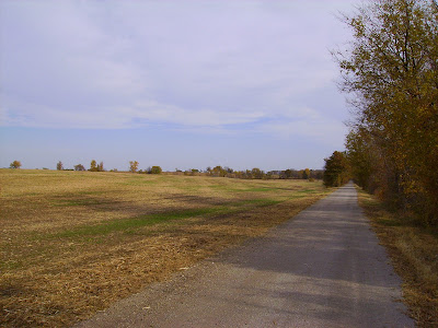
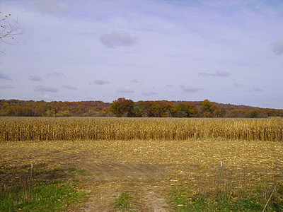
Well back from riding the Katy trail through central Missouri. The trip did not end as planned due to lake of foresight on my part, but we'll get to that later.
I started the ride from Kirwood, a suburb of St. Louis taking Amtrak to Sedalia, MO.
 |
| Tracks heading west |
 |
| Kirkwood Station |
|
| |
|
It was a rainy dreary day, so upon arrival in Sedalia I rode from the train station to my hotel for the night.
 |
| Hotel Bothwell, built in 1927 toward the end of the rail road boom in Sedalia, was considered the most high class hotel in this part of Missouri at the time of its construction |
 |
| Looking across the town square in Sedalia |
 |
| Main Street Sedalia |
 |
| The queen size bed took almost the entire room, but you had your own private bath and shower. The height of luxury in mid-Missouri in the 1920's |
Thursday the 27th was my first full day of riding, 39 miles in total as I got turned around a bit riding out of Sedalia to the trail head.
 |
| Sedalia Depot one of two remaining original depots along the trail |
Initially the country side was flat and filled with farms as I passed through the Osage Plains region of Missouri.
Slowly the landscape transitioned to the Ozark Border lands becoming more rocky with low rolling hills as I approached Boonville and the Missouri River.
 |
| The fall colors were nice in central Missouri unlike the Oak dominated Ozarks |
 |
| Not much left of the old MKT (Katy) line other than trestles, telegraph wires, old mile markers, and this switch light |
Boonville, on the Missouri River, was the destination for my second night on the trail.
 |
| Boonville Station |
 |
| Hotel Fredrick the nicest place, and most expensive, that I'll stay on my trip |
 |
| Barge passing under an old hi-low bridge of the MKT on the Missouri River |
Friday the 28th was to be my longest day on the trail at 60 miles riding to Tebbetts, MO a town of 50 people which includes a bar and post office.
Just outside of Rocheport, MO you enter one of the most beautiful sections of the trail as you're on the banks of the Missouri with 150'+ bluffs rising on the opposite side.
 |
| Lewis and Clark Cave right on the side of the trail |
 |
| The cave has a spring coming out of it and is on private property so I did not go any further |
 |
| After passing through Rocheport you pass north of Jefferson City, MO which is the state capital. The odd thing about Jefferson City is its size. Only 43,000 people live here and you can tell how rural it gets just outside of the city. Hard to tell from this picture but the high building in the center of the picture is the Capital Dome. |
|
 |
| Hostel in Tebbetts, only $5 a night but a bit more primitive than the previous nights lodging |
 |
| Tebbetts cows. Just keep moooving along. |
Leaving Tebbetts the following morning the plan was to ride 53 miles to Marthasville where I would camp for the night, but sadly nature and lack of preparation on my part would cut my ride short. About 12 miles into the day I must of ran over a thorn as my rear tire developed a slow leak. I pumped the tire back up and rode 15 more miles to Rhineland, MO where the tire flatted again and this time would not hold air. I pulled the tube and checked for a thorn but was unable to locate it, and installed my spare inner tube. 5 miles further down the rode my new tube was flat as well, and would not hold air. At this point I was at the spur trail for Herman, I was out of tubes and had forgot to bring my patch kit. A two mile walk lead me over the Missouri and into town where I arrived at the Amtrak station just in time to witness a bachelorette party leaving the train and hop aboard for a ride back to Kirkwood and my truck. Overall I lost a day and a half and about 60 miles of trail, but as this was my first extended tour on a bike I'll just chalk it up to a learning experience. Always be prepared no matter how tame the terrain. A few more pictures to follow for your viewing pleasure.
 |
| Standing Rock on which the flood levels of the Missouri have been marked since 1903 |
 |
| Cliffs outside Bluffton, MO the highest on the trail rising some 200' overhead |
 |
| Farmland outside of Rhineland so named by the German immigrants who settled this area as it reminded them of the Rhine Valley region of Germany. |
 |
| Missouri River crossing over to Herman. I wish I would've taken a picture of the trail as its a neat town right on the river and Octoberfest was going on, but I pressed through town to get to the train |


No comments:
Post a Comment