
Oct. 5th dawned bright and sunny. The plan for today was to ride the ridge line opposite of the trails I rode on Day 1. Started with a steep climb up Ross Camp to Mountain Top trail, a climb of about 2.5 miles up fairly steep grades. The one saving grace was the trail bed was smooth, if not a bit narrow in places.

Trail climbing up Mountain Top Trail. You can't really tell from this photo but this is a side hill trail with a fairly steep drop off to the left.

Ridge line of Mountain Top Trail.

From Mountain Top trail you descend to Beard's Gap and then continue climbing on the above trail called Brush Hollow Trail. Narrow and tight side hill climbing.

View of the Cowpasture River Valley from the top of Brush Hollow Trail. 3 miles of descending from here.

A swtich back on Brush Hollow Trail. There are about 8 as you drop down the mountain side.
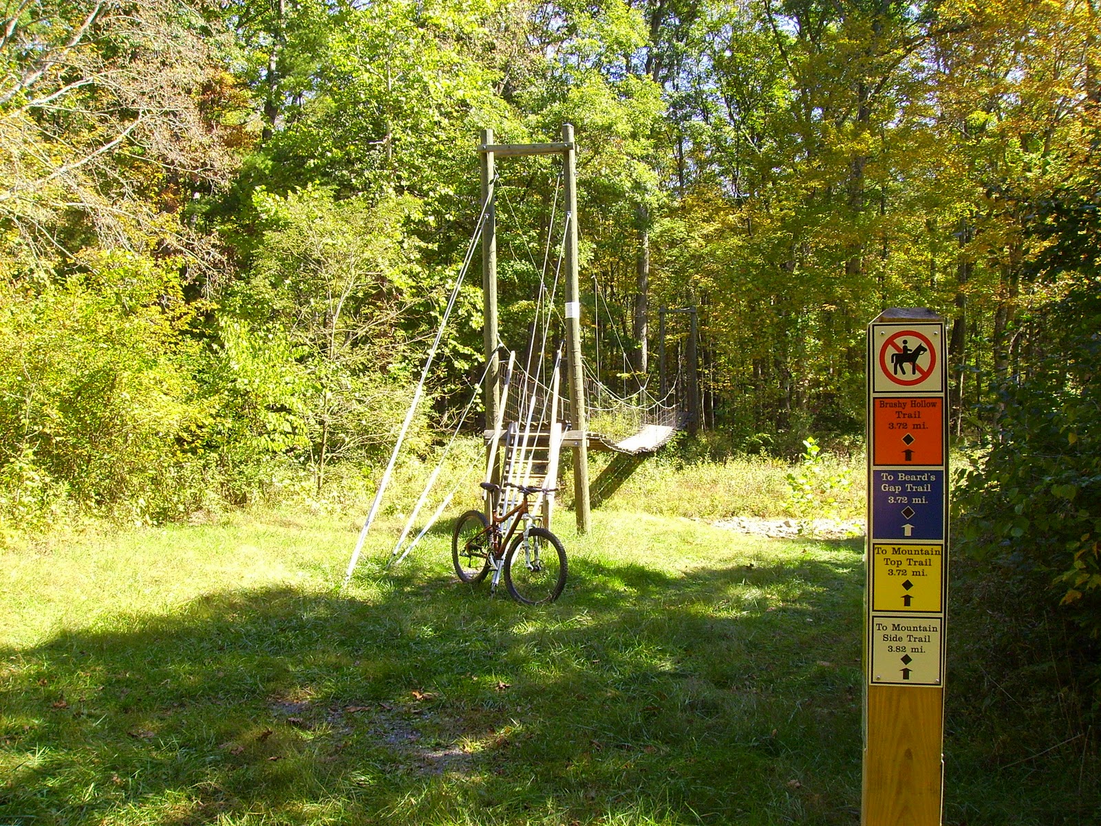
Rickety old suspension bridge at the trail head of Brush Hollow trail crossing over Wilson Creek. My favorite part of this picture is the "No Horses" sign. Post hole digging trail crappers aren't allowed on the majority of the trails in the park, and it shows in the trail beds.
People ask why don't I take photos of myself when I'm riding? Well here's your answers...


The plan for day three, today, involved a 22 mile route that would have me climbing both ridge lines the previous two days. As you can tell from the above photos that's a lot of girth to be carrying up mountains.

Started out with a 1 mile climb up Beard's Hollow Trail across Locust Gap Trail to Blue Suck Falls Trail and finally a brutal climb of about 3 miles up Pine Tree and Salt Stump Trails. The reward for this suffering was...

A mile and a half of awesome ridge top riding on Middle Mountain Trail. No climbs, mostly flat to rolling with the mountain side falling off to each side.


Middle Mountain rocked. Literally and figuratively.
From Middle Mountain I descended 3.5 miles on Stony Run trail which I had climbed on Day 1. Awesome, awesome descent. Good sight lines and trail surface allowed me to ride 20+ mph downhill. If you've ever wondered what it would be like to run through the woods like a deer, this is as close as you'll get.

Top of Stony Run. Had too much fun on the way down to stop for photos.

From Stony run I stretched my legs for about 5 miles on the park road and Flat Run trail before my final ascend of the day pictured above: Beard's Gap Trail. From Beard's Gap I hit Brush Hollow one more time to end my day, and stay in Douthat State Park. Heading into West Virginia next, to Watoga State Park, Greenbrier River Trail and the Monongahela National Forest.
No comments:
Post a Comment