I will be camping at Blanchard Springs Campground about 15 miles outside of Mountain View, Arkansas. I doubt I'll have cell service so watch for the Spot messages. I will do two "OK" messages one at the trail head and another once I'm done riding and back at my camp site. The trails I will be riding are called Syllamo Trail system composed of about 5 different trails of varying length, but with about 50 miles or total riding available. I'm not sure what trail I'll be riding each day, but for at least one of the trails I can ride straight out of the campground to get on it. Here's a list of the trails: http://www.syllamosrevenge.com/Trail/trail.html
And a map in PDF form: http://www.syllamosrevenge.com/Maps/maps.html
I will be staying at Blanchard Springs until Saturday or Sunday when I'll be heading south towards Hot Springs. I'll give you a call when I leave.
Monday, October 31, 2011
Sunday, October 30, 2011
Katy Trail October 26 - 29th
Well back from riding the Katy trail through central Missouri. The trip did not end as planned due to lake of foresight on my part, but we'll get to that later.
I started the ride from Kirwood, a suburb of St. Louis taking Amtrak to Sedalia, MO.
It was a rainy dreary day, so upon arrival in Sedalia I rode from the train station to my hotel for the night.
Thursday the 27th was my first full day of riding, 39 miles in total as I got turned around a bit riding out of Sedalia to the trail head.
Initially the country side was flat and filled with farms as I passed through the Osage Plains region of Missouri.
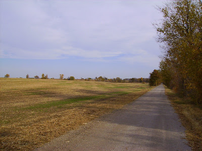

Slowly the landscape transitioned to the Ozark Border lands becoming more rocky with low rolling hills as I approached Boonville and the Missouri River.


Boonville, on the Missouri River, was the destination for my second night on the trail.
Friday the 28th was to be my longest day on the trail at 60 miles riding to Tebbetts, MO a town of 50 people which includes a bar and post office.


Just outside of Rocheport, MO you enter one of the most beautiful sections of the trail as you're on the banks of the Missouri with 150'+ bluffs rising on the opposite side.


Leaving Tebbetts the following morning the plan was to ride 53 miles to Marthasville where I would camp for the night, but sadly nature and lack of preparation on my part would cut my ride short. About 12 miles into the day I must of ran over a thorn as my rear tire developed a slow leak. I pumped the tire back up and rode 15 more miles to Rhineland, MO where the tire flatted again and this time would not hold air. I pulled the tube and checked for a thorn but was unable to locate it, and installed my spare inner tube. 5 miles further down the rode my new tube was flat as well, and would not hold air. At this point I was at the spur trail for Herman, I was out of tubes and had forgot to bring my patch kit. A two mile walk lead me over the Missouri and into town where I arrived at the Amtrak station just in time to witness a bachelorette party leaving the train and hop aboard for a ride back to Kirkwood and my truck. Overall I lost a day and a half and about 60 miles of trail, but as this was my first extended tour on a bike I'll just chalk it up to a learning experience. Always be prepared no matter how tame the terrain. A few more pictures to follow for your viewing pleasure.


I started the ride from Kirwood, a suburb of St. Louis taking Amtrak to Sedalia, MO.
 |
| Tracks heading west |
 | ||||
| Kirkwood Station |
 |
| Hotel Bothwell, built in 1927 toward the end of the rail road boom in Sedalia, was considered the most high class hotel in this part of Missouri at the time of its construction |
 |
| Looking across the town square in Sedalia |
 |
| Main Street Sedalia |
 |
| The queen size bed took almost the entire room, but you had your own private bath and shower. The height of luxury in mid-Missouri in the 1920's |
 |
| Sedalia Depot one of two remaining original depots along the trail |


Slowly the landscape transitioned to the Ozark Border lands becoming more rocky with low rolling hills as I approached Boonville and the Missouri River.


 |
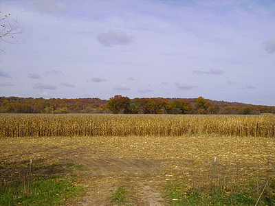
| The fall colors were nice in central Missouri unlike the Oak dominated Ozarks |
 |
| Not much left of the old MKT (Katy) line other than trestles, telegraph wires, old mile markers, and this switch light |

Boonville, on the Missouri River, was the destination for my second night on the trail.
 |
| Boonville Station |
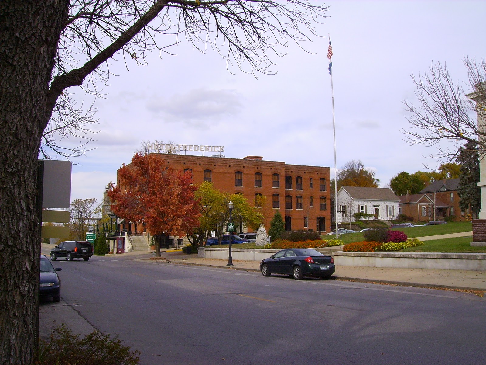 |
| Hotel Fredrick the nicest place, and most expensive, that I'll stay on my trip |
 |
| Barge passing under an old hi-low bridge of the MKT on the Missouri River |


Just outside of Rocheport, MO you enter one of the most beautiful sections of the trail as you're on the banks of the Missouri with 150'+ bluffs rising on the opposite side.


 |
| Lewis and Clark Cave right on the side of the trail |
 |
| The cave has a spring coming out of it and is on private property so I did not go any further |
 | |
| After passing through Rocheport you pass north of Jefferson City, MO which is the state capital. The odd thing about Jefferson City is its size. Only 43,000 people live here and you can tell how rural it gets just outside of the city. Hard to tell from this picture but the high building in the center of the picture is the Capital Dome. |

 |
| Hostel in Tebbetts, only $5 a night but a bit more primitive than the previous nights lodging |
 |
| Tebbetts cows. Just keep moooving along. |
 |
| Standing Rock on which the flood levels of the Missouri have been marked since 1903 |
 |
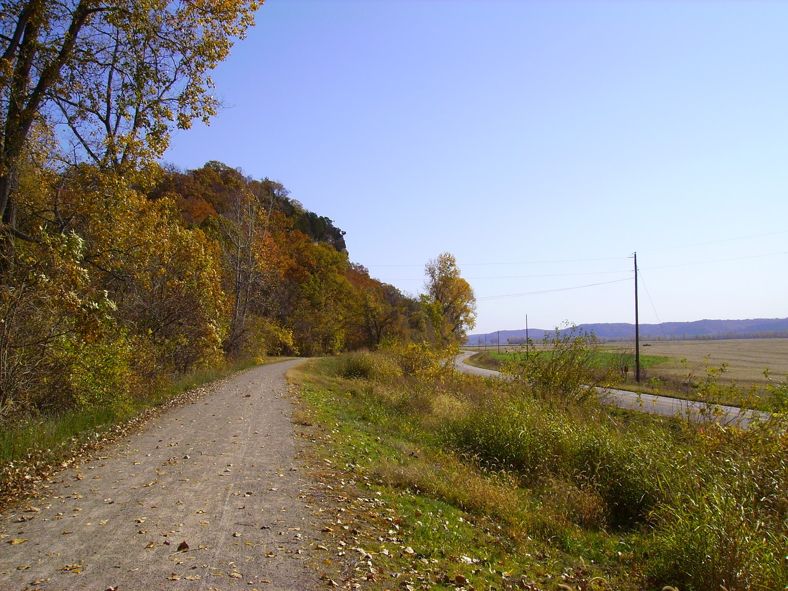
| Cliffs outside Bluffton, MO the highest on the trail rising some 200' overhead |

 |
| Farmland outside of Rhineland so named by the German immigrants who settled this area as it reminded them of the Rhine Valley region of Germany. |
 |
| Missouri River crossing over to Herman. I wish I would've taken a picture of the trail as its a neat town right on the river and Octoberfest was going on, but I pressed through town to get to the train |
Tuesday, October 25, 2011
Katy Trail Itinerary
Listen, well read really, up family because here are my plans from Wed. Oct. 26th through Sun. Oct. 30th. I will be riding Amtrak from Kirkwood, MO to Sedalia, MO tomorrow leaving at 0944 and arriving in Sedalia at 1246. I will be spending the afternoon and night in Sedalia as it will be raining. I will be staying at the Hotel Bothwell. Thursday morning I will be riding out of Sedalia eastward on the Katy Trail 38 miles to Boonville. I will be staying in Boonville overnight at Hotel Frederick. Friday I will be riding 60 miles from Boonville to Tebbetts. There is no hotel in Tebbetts instead I'll be staying at the Turner Katy Trail Hostel. From Tebbetts its 53 miles on Saturday to Marthasville where I'll be camping overnight at the Community Club Park right off the trail. The final leg of the trail will be on Sunday 38 miles from Marthasville to St. Charles, MO. In St. Charles I've arranged a shuttle to take drive me back to where my car in Kirkwood. I'll have cell phone coverage for most of the trail I'm sure, but you can click on the links above to contact the hotels if you need me for any reason Wed or Thurs night.
St. Louis Riverfront Trail

Yesterday, Oct. 24th, I rode the St. Louis Riverfront trail and part of the Confluence Trail in Illinois for a total of 32 miles. Here are a few of the images. I'm not going to write too much on this entry so just enjoy the pictures.

Riverfront trail along the top of the levee.

Approaching St. Louis from the industrial north side of town on the Riverfront Trail.


St. Louis skyline from Jefferson Expasion Memorial Busch Stadium is on the far left.

Ead's Bridge with a monument to Lewis and Clark in the foreground.

The detail and craftsmanship on some of the old industrial buildings is amazing. Sorry I don't have a camera really capable of capturing the detail. Many of these old buildings are disappearing. This building was, and still is, a power plant.

Merchant's Bridge


Chain of Rocks Bridge and old Route 66 across the Mississippi


Confluence of the Missouri and Mississippi Rivers, the Missouri is coming in from the left. Sorry I couldn't get a better photo, the observation tower was closed.

Levee riding on the Confluence Trail with the Choteau island canal to the right. This is how the barges get past the low water damn and rapids just below the Chain of Rocks bridge.
Subscribe to:
Comments (Atom)