Thursday, August 14, 2014

Rocky Mountain National Park - Glacier Creek Trail to Black Lake


Crossing Glacier Creek at the start of the trail. Glacier Creek trail is flat to slightly ascending until it reaches the junction with the trail leading up from Glacier Gorge Trail Head just below Chaos Canyon Cascades.


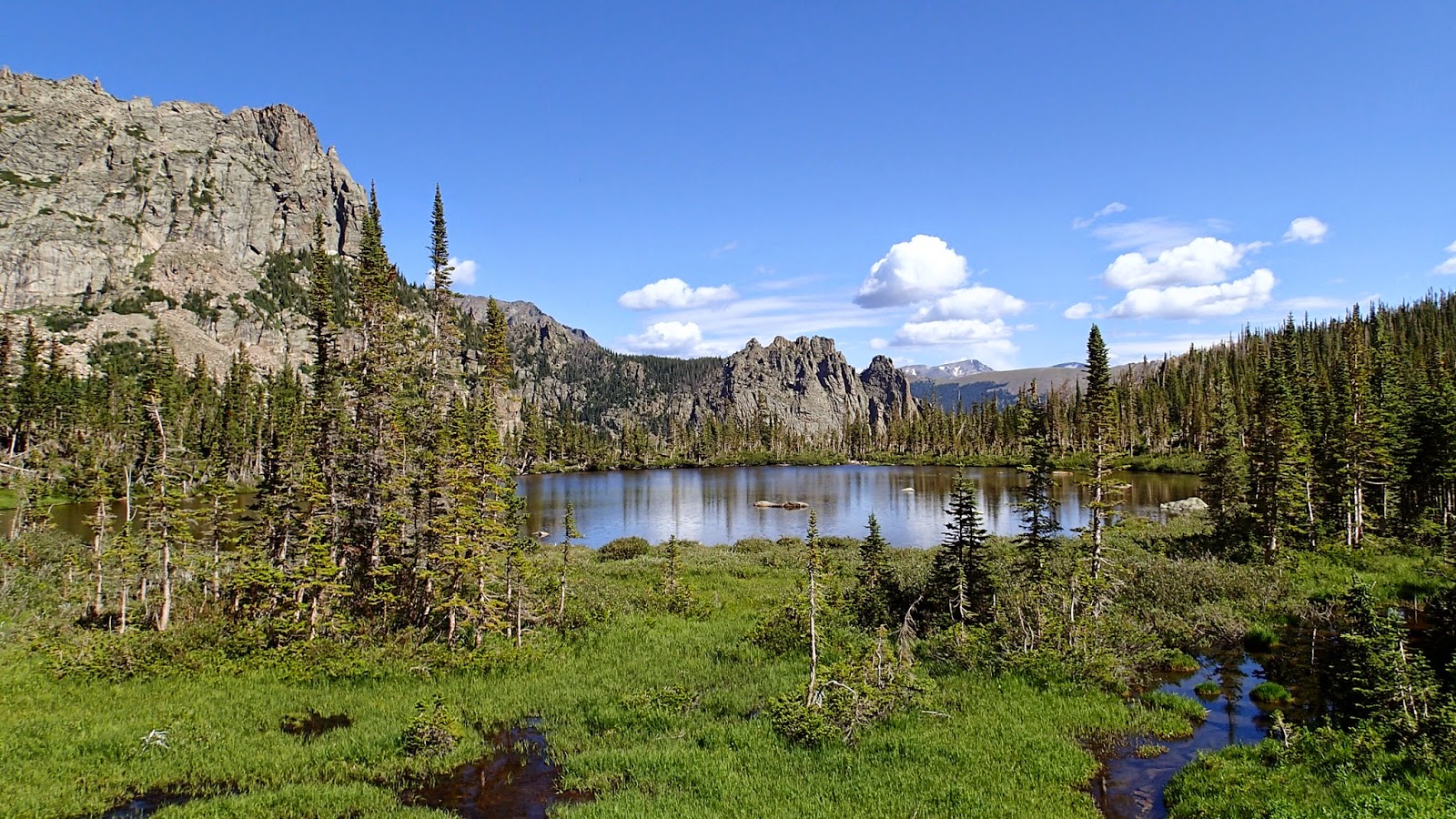
Glacier Creek trail is peaceful and less traveled compared to the trails around Bear Lake and Glacier Gorge which it heads up to. A small lily covered pond on the way up Glacier Creek Trail provides a view towards the Glacier Gorge where Mills and Black lakes reside.


Approaching Glacier Gorge on a heavily traveled trail. Took a couple of minutes to let people pass to snap this shot.


Looking up Glacier Gorge with Mills Lake in the foreground. Black Lake is 2 miles up the gorge to the right.

Heading up Glacier Gorge past Mills Lake.


Higher up Glacier Gorge about midway between Mills and Black Lakes. This section of the trail reminded me of hiking in the Great Smoky Mountains National Park. Trail is littered with roots, rocks, and follows a rocky stream throughout the entirety of the course.


Falls at the outlet of Black Lake. A quick scramble up the left side of the falls leads you to...

...this view looking back down Glacier Gorge, and to...


Black Lake.


The mountains rise in sheer cliffs from Black Lake like cathedrals encircling a large reflecting pond.
There is not much room around the base of Black Lake for hikers, and you have to be a bit creative in getting pictures. The good thing is the hike is hard enough, and long enough that you'll shed most of the crowds at Mills Lake. I did have a taste of Rocky Mountain weather on the way back when a strong storm blew through with pea sized hail which came down hard enough to cover the ground.


The storm passed quickly and the skies were blue again by the time I got back to Mills Lake for the hike back down to Glacier Gorge Trail Head for a shuttle back to the campground.

Wednesday, August 13, 2014

Rocky Mountain National Park - Bear Lake to Fern Lake Trail Head


One of the great things about Rocky Mountain National Park is the shuttle system which allowed me to access all my hikes from my base camp in Moraine Park Campground. Most of my hikes began here at Bear Lake which sits around 9,400' of elevation. The hike from Bear Lake to Fern Lake allowed me to walk one way back to my campsite totaling around 10 miles.


The trail gently ascends from Bear Lake...


...along the base of Flat Top Mountain approaching, but never quite going above, treeline.


Getting closer to the top of the climb. Some nice rock work done to stabilize the trail through this scree field.


Boulder field near Two Rivers Lake. Notch Top in the background.


Notch Top near Lake Helene.


Lake Helene is a spur trail off of the main trail before you begin the descent to Odessa Lake. The spur is unmarked and goes left as the main trail turns hard right around Joe Mills Mountain.


Looking back towards Notch Top as you begin the descent. The melting snow fields create many small waterfall down the base of Notch Top, sadly I wasn't able to capture any very well with my camera.


Descending down to Odessa Lake; absolutely beautiful views as the trail falls of sharply to your left providing open panoramas of the lake and surrounding mountains.


Odessa Lake looking back up towards Notch Top, in the center, and Little Matterhorn to the right.


Fern Lake through the trees.


Looking back up towards Notch Top and Little Matterhorn from Fern Lake. From this point the trail descends rapidly to the Big Thompson River which you follow out to the Fern Lake Trailhead 1.7 miles below.

Wednesday, August 6, 2014

Curt Gowdy State Park - Trail Pictures


The trails at Curt Gowdy State Park offer excellent riding opportunities for riders from beginner to advanced, and options of 20+ mile rides without riding the same trail twice. The trails pass through 3 distinctive terrain types: high plains grasslands to the east around Crystal Reservoir, small canyons between Crystal and Granite Reservoirs, and forested upper slopes with many rock features. The trail above is Crystal Ridge Trail approaching Canyons trail.


It has been a rather rainy summer in this part of Wyoming so the grass is still green, and wild flowers are prolific. Above is Crystal Ridge Trail close to far eastern end of the park passing through high plains terrain. The trail is rated as moderate; mild climbs with no real obstacles, the trail is as pictured above along most of its length.


You can circumnavigate Crystal Reservoir via a combination of Crystal Ridge Trail, Canyons Trail, and Cliffhanger Trail. In the picture above Cliffhanger Trail follows the ridge to the left while Canyons Trail is visible along the far side of the reservoir at the base of the cliffs.


Cliffhanger gets its name from the side hill nature of the trail along the west end of Crystal Reservoir. This is the only real technical/dangerous feature of the trail. The sign tells you to dismount before curving around the ridge. There is a 40' drop to the lake with a very narrow, loose, descent that would not be difficult at all if not for the severe price of failure to the left. The chain for hand hold is a bit much however as you can safely walk this short section.


This picture more typifies the surface of Cliffhanger Trail, to the right, as it climbs the side of the ridge along Crystal Reservoir. Canyons Trail, to the left, appears sedate, but quickly becomes extremely technical in less than a mile.


Canyons trail climbs, or descends, the rocks to the left before crossing towards the right of this picture. Can you find the trail?

Looking across the small canyon which Canyon's trail crosses. You drop from the top of the ridge down to the valley, and come back up very quickly onto the ridge where this photo was taken. The far side of Canyons is rated as "advanced" and is rideable by some one of my skill level. The section of Canyons from which this picture was take is considered "expert" and requires multiple hike a bike sections with some severe exposure. In this case steep descents on narrow trails, lots of rocks, with sheer drops. Mountain biking is hiking at times.

Looking back the from the north ridge line of Canyons trail from a rideable portion, for me, of the trail.


The trails on the western end of the park are at high altitude and more typify rocky mountain riding with plenty of tree cover from pines and aspen groves, creeks, and rock formations. The above picture is from the junction of Stone Temple Circuit and Albert's Alley.


Moderate rated Stone Temple Circuit ascending gently towards its intersection with Ignoramus trail, an advanced level trail, and Rock 'n Roller. Stone Temple Circuit is a fairly smooth trail throughout its 5 mile course, with great flow, and just enough rocks to keep  you honest. Chameleon Rock can be seen towards the middle of the photo.


Stone Temple Circuit with storm approaching.


Pinball Trail connects Stone Temple Circuit with Crow Creek trail. Rated "advanced" due to the numerous rock features along the trail. Chameleon rock in the background.


Easy section of Pinball Trail, terrain getting more rocky.


Typical Pinball Trail with rocks to navigate surrounded by large boulders on all sides.


The last picture is of a unique section of trail along El Alto which takes you through the highest terrain in the park. Trail passes under a boulder that looks to be precariously balanced between two other rock formations. I didn't take pictures of all the trails in the park, but did have the ability to ride all the trails over my 3 day stay. I would have to rate Stone Temple Circuit and Mo' Rocka trails as my favorites. Stone Temple due to flow of the trail, and Mo' Rocka as just technical enough to challenge me without being overly dangerous. The entire trail system is rideable by a mountain biker with an acceptable fitness level as the altitude will hit you, and with moderate to limited technical ability. There is no shame in walking anything that is too intimidating, but for the most part you can challenge yourself in relative safety. The one caveat would be the far eastern "black diamond" section of Canyons trail. It is extremely steep, rocky, with serious exposure, but the views and challenge are well worth it.

Curt Gowdy State Park - Scenery Pictures


I'm going to split the blog entries for Curt Gowdy State Park into two separate entries due to the sheer amount of photos. The first entry will focus on pure scenery pictures with very little commentary, and the second will focus on shots of the trails with brief descriptions of the variety of terrain available in this small state park.


Curt Gowdy State Park is dominated by two lakes; Crystal Reservoir pictured about and Granite Reservoir pictured below. There are over a hundred campsites with the majority surrounding both of these lakes. Crystal appears to be the quieter of the two, however, as boat use is allowed on Granite.


The scenery in Curt Gowdy State park changes as you go westward from Crystal Reservoir towards Granite and above into the "high country" changing from high plains scenery with sweeping vistas, through a gorge that separates the two reservoirs, to more typical Rocky Mountain Scenery at the west end of the park. Elevations range from 6,500' at the east end to almost 8,000 on the highest points of the western end of the park.


Hike up a small slot canyon on Crow Creek at the western end of the park, and go around this pool and you'll find...

...Hidden Falls.


The view looking back across the park from the overlook on El Alto Trail.

Friday, August 1, 2014

Lions, and Tigers, and Mountain Bike Trails...Oh, my!


Who knew there were good mountain bike trails in Kansas of all places? Just 6 miles off of I-70 near Wilson, Kansas is Wilson Lake State park home to the IMBA Epic Switchgrass Trails. The trail system boasts slightly over 21 miles of sinuous single track ranging from a 6 mile kids/beginners loop to an advanced loop requiring technical rock handling skills on the Golden Belt Loop. The above photo is of Brokebike Mountain on the Marina Loop, and gives a good feel for how the trails meander along the topography of the park.


Hell Creek loop follows the contour of the ridge to the south of the road to Lake Wilson State Park. As the trail dips down the ridge you follow a narrow strip of trail with moderate cliff side exposure to help maintain your focus.

Hell Creek loop weaves in and out of small gulches along the ridge line.


Cliff exposure on Hell Creek loop. Along with the threat of falling off the trail there were plenty of lizards to keep you focused on your front wheel through this section.


Scenery along the more sedate EZ loop which is the starting and ending trail if you do the full loop from the trail head parking lot.


Buff section of trail along the EZ loop.

Lots of wild life to be seen along the trail. I lost count of the number of lizards and turtles I saw along, and in, the trail. The most amusing was the collared lizard which runs on its hind legs. I had seen this behavior on natural history shows on TV, but I burst out laughing not expecting this behavior from lizards in Kansas. The lizard starts out running on all fours, then jumped up onto its rear legs and puts it in overdrive to get away from my front wheel. I also saw what I believe to be a snake that's not really a snake. I'm pretty sure it was a Glass Lizard, but I only got a quick look at it before it took off into the grass. I moved at least 5 Ornate Box Turtles from the trail to keep them from being ran over. I also saw one Horny Toad!

Gratuitous Horny Toad picture