Thursday, November 10, 2011

Arkansas Ozarks October 31st - November 5th

Well time to get caught up from the last 2 weeks. I'll start with the week I spent in the Ozarks of north central Arkansas near the small town of Mountain Home. I've wanted to re-visit this area since my trip here 2 years ago when torrential rain for 4 days kept me from riding Syllamo Epic. I spent the first 3 nights camping at the Gunner Pool primitive campground, and was the only person around for miles. The first few pictures are taken from the campground or near the campground.

North Sylamore Creek


North Sylamore Creek Trail


Rocky beach and crystal clear creek 50' from my camp site
The first trail I rode was Jack's Branch Loop which kind of put a sour taste in my mouth for the Syllamo trail system. At 14 miles long its the longest section of trail, with constant ups and downs on a loose over hard pack trail bed, which made it difficult to power up the short climbs. The trail was mildly technical in places, but otherwise fairly beginner friendly. The main negative to the trail was how overgrown in was in places with briars encroaching on the trail which caused both a front and rear flat, and left me picking a total of 8 thorns out of my front tire after the ride. I either needed to be running slime tubes or going tubeless for this trail as I normally don't have problems with briars in WNC.

Jack's Branch Trail

A little rocky at times, but nothing too bad

North Sylamore Creek from a bluff about 600' above the river

Blanchard Springs Campground where I was to originally camp, but closed for bridge repair, lays just below the cliff along the river


After missing out on a nice day Wednesday due to my battery going dead and me having to sit and wait for a couple hours on the dirt road that runs through the campground for some one to jump me off; I didn't get to ride again until Friday. On tap for my next ride was Bad Branch and White River Bluff Loop. Bad Branch at 12 miles is rated as the easiest trail, and had a much better flow than Jack's Branch with no major climbs and no technical obstacles leaving me wishing for my single speed. The only thing slowing me down was the loose over hard pack trail surface to which my tires aren't suited.

Arkansas Ozarks are more colorful than the Missouri Ozarks as the forests aren't Oak dominated


From Bad Branch I rode the White Bluff Loop trail which is the shortest in the system at 4.5 miles. The highlights of this trail are the views from the bluffs of the White River and the more technical trail surface.


White River with JoJo's Catfish House just below, good eatin' after a day of riding

This part of the Ozarks doesn't appear very "mountainous" as it is merely an eroded plateau

Cliff top riding, don't lean too far left or you're in for a drop of 300'

Mmm...Arkansas chunk. Something I'd become even more familiar with the following day
The final day of riding included a large loop combined of Scrappy and Bald Scrappy Mountain trails. These two trails are considered to be the most technical and include the most climbing as the trail head starts in the valley. I had one real good down hill, but for the most part it seemed like I was climbing most of the day.

Climbing Bald Scrappy, the clouds just would not break up like the weathermen kept claiming they would

Trail through the cedars on Bald Scrappy
Easy riding Chunk

Tougher to ride chunk as you're climbing, almost made it but lost momentum as you reach the tree at the top and make a sharp left turn

Smoother section of trail on Scrappy Mountain Trail

The chunk continued on Scrappy Mountain Trail as did the climbing

Top of a little obstacle dubbed "the Stairway to Heaven"

Pic from the bottom of "Stairway to Heaven" prior to riding it. Always check your run out on a new trail, especially when you're by yourself in the middle of the Arkansas Ozarks

A little more chunky monkey as you approach the end of the trail, fun stuff

From Mountain View it was south to Hot Springs and the Ouachita's. Stay tuned.

Wednesday, November 9, 2011

Talimena Scenic Highway

Spent the day driving the Talimena Scenic Byway which runs along a mountain ridge line between Mena, Arkansas and Talihina, Oklahoma. I've got quite a few pictures of riding in the Arkansas Ozarks and Ouachitas that I'll get to some time in the near future. In the mean time enjoy the scenery of South Western Arkansas and Eastern Oklahoma.


Monday, October 31, 2011

Plans for the next several days...

I will be camping at Blanchard Springs Campground about 15 miles outside of Mountain View, Arkansas. I doubt I'll have cell service so watch for the Spot messages. I will do two "OK" messages one at the trail head and another once I'm done riding and back at my camp site. The trails I will be riding are called Syllamo Trail system composed of about 5 different trails of varying length, but with about 50 miles or total riding available. I'm not sure what trail I'll be riding each day, but for at least one of the trails I can ride straight out of the campground to get on it. Here's a list of the trails: http://www.syllamosrevenge.com/Trail/trail.html
And a map in PDF form: http://www.syllamosrevenge.com/Maps/maps.html

I will be staying at Blanchard Springs until Saturday or Sunday when I'll be heading south towards Hot Springs. I'll give you a call when I leave.

Sunday, October 30, 2011

Katy Trail October 26 - 29th

Well back from riding the Katy trail through central Missouri. The trip did not end as planned due to lake of foresight on my part, but we'll get to that later.

I started the ride from Kirwood, a suburb of St. Louis taking Amtrak to Sedalia, MO.

Tracks heading west


 Kirkwood Station


It was a rainy dreary day, so upon arrival in Sedalia I rode from the train station to my hotel for the night.
Hotel Bothwell, built in 1927 toward the end of the rail road boom in Sedalia, was considered the most high class hotel in this part of Missouri at the time of its construction

Looking across the town square in Sedalia

Main Street Sedalia
The queen size bed took almost the entire room, but you had your own private bath and shower. The height of luxury in mid-Missouri in the 1920's
Thursday the 27th was my first full day of riding, 39 miles in total as I got turned around a bit riding out of Sedalia to the trail head.

Sedalia Depot one of two remaining original depots along the trail
Initially the country side was flat and filled with farms as I passed through the Osage Plains region of Missouri.


Slowly the landscape transitioned to the Ozark Border lands becoming more rocky with low rolling hills as I approached Boonville and the Missouri River.


The fall colors were nice in central Missouri unlike the Oak dominated Ozarks

Not much left of the old MKT (Katy) line other than trestles, telegraph wires, old mile markers, and this switch light


Boonville, on the Missouri River, was the destination for my second night on the trail.

Boonville Station

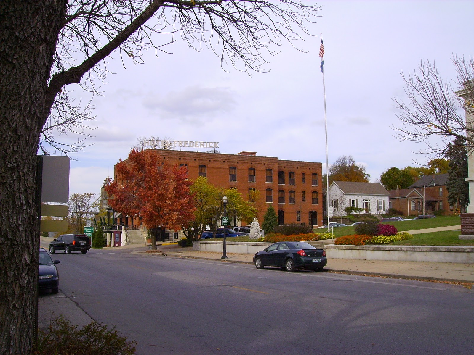
Hotel Fredrick the nicest place, and most expensive, that I'll stay on my trip
Barge passing under an old hi-low bridge of the MKT on the Missouri River
Friday the 28th was to be my longest day on the trail at 60 miles riding to Tebbetts, MO a town of 50 people which includes a bar and post office.


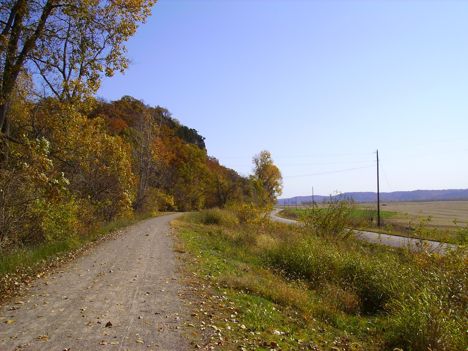
 Just outside of Rocheport, MO you enter one of the most beautiful sections of the trail as you're on the banks of the Missouri with 150'+ bluffs rising on the opposite side.


Lewis and Clark Cave right on the side of the trail

The cave has a spring coming out of it and is on private property so I did not go any further
After passing through Rocheport you pass north of Jefferson City, MO which is the state capital. The odd thing about Jefferson City is its size. Only 43,000 people live here and you can tell how rural it gets just outside of the city. Hard to tell from this picture but the high building in the center of the picture is the Capital Dome.

Hostel in Tebbetts, only $5 a night but a bit more primitive than the previous nights lodging
Tebbetts cows. Just keep moooving along.
 Leaving Tebbetts the following morning the plan was to ride 53 miles to Marthasville where I would camp for the night, but sadly nature and lack of preparation on my part would cut my ride short. About 12 miles into the day I must of ran over a thorn as my rear tire developed  a slow leak. I pumped the tire back up and rode 15 more miles to Rhineland, MO where the tire flatted again and this time would not hold air. I pulled the tube and checked for a thorn but was unable to locate it, and installed my spare inner tube. 5 miles further down the rode my new tube was flat as well, and would not hold air. At this point I was at the spur trail for Herman, I was out of tubes and had forgot to bring my patch kit. A two mile walk lead me over the Missouri and into town where I arrived at the Amtrak station just in time to witness a bachelorette party leaving the train and hop aboard for a ride back to Kirkwood and my truck. Overall I lost a day and a half and about 60 miles of trail, but as this was my first extended tour on a bike I'll just chalk it up to a learning experience. Always be prepared no matter how tame the terrain. A few more pictures to follow for your viewing pleasure.

Standing Rock on which the flood levels of the Missouri have been marked since 1903
Cliffs outside Bluffton, MO the highest on the trail rising some 200' overhead


Farmland outside of Rhineland so named by the German immigrants who settled this area as it reminded them of the Rhine Valley region of Germany.
Missouri River crossing over to Herman. I wish I would've taken a picture of the trail as its a neat town right on the river and Octoberfest was going on, but I pressed through town to get to the train