|
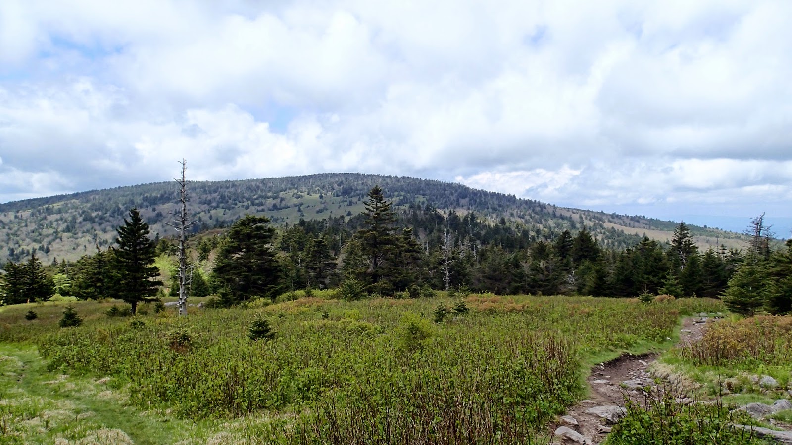
| Grayson Highlands. Center ridge is the summit of Mt. Rogers with White Top Mountain off to the distance on the left. |
Plan for the day was a day hike from Grayson Highlands State Park to the top of Mt. Rogers. This is an area that I've been wanting to explore for years, but had never found the time. It was always easier to head to closer high country locations such as Black Balsam/Graveyard Fields or the Roan Highlands when I lived in NC. Of the three I consider this area of open high country to be the most scenic. The terrain is more varied and you have multiple route options to explore. I planned to stick with an easy route to the summit of Mt. Rogers parking in the Massie Gap Parking area and ascending mostly along the AT to Mt. Rogers.
 |
| View along the Rhododendron Trail just out of the Massie Gap Parking area |
The hike began along the Rhododendron Trail which is through a gait straight across from the Massie Gap Parking area. As the trail crests the ridge it turns into a double track and quickly accesses the AT. From here you have two options; you can take a left Southbound onto the AT or stay straight on the double track for a little less than a quarter of a mile until you come to the border of Grayson Highlands State Park which is marked by a information station and gate.
Once you pass through the gait you ascend up the ridge on the AT with a side option of about 1 mile on the Wilburn Ridge Trail which runs back into the AT. Wilburn Ridge Trail ascends quickly up and over two rock outcroppings along the ridge, with some scrambling involved, and provided 360 degree views of the surrounding mountains. The following five pictures were taken from Wilburn Ridge Trail:
 |
| Gap along Wilburn Ridge Trail with second small climb in the foreground. |
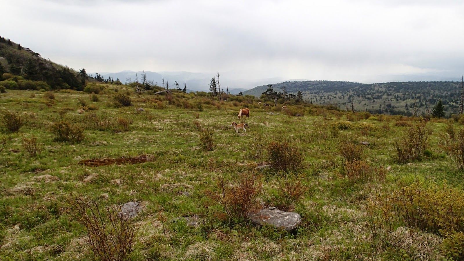
Wilburn Ridge Trail rejoins the AT at this gap. The AT ascends the next small rock outcropping to the left of the image before turning south towards Mt. Rogers. This is where I had my first encounter of the day with the ponies of the Grayson Highlands.
 |
| Stallion in the foreground watching over his mares. |
The AT continues to gently ascend through fir forests and open areas up towards the summit of Mt. Rogers.
No views to be had from the summit of Mt. Rogers as it is fully encased in fir trees. The summit is quiet and open enough to allow the sun in to provide warmth while you sit on a boulder and eat a bit of lunch.
On the trip back I passed another group of ponies which I had seen from a distance on my way through earlier in the day.
The first group of ponies finally decided to move from the shelter of the rock where I found them earlier in the day as I came back through.
And moved to the gap where the AT and Wilburn Ridge Trail intersects. This foal was playing as I walked through the gap, galloping around the mares, and whinnying as loud as he could. Wish I had a better camera to capture this.
Although I kept my distance from the ponies during the hike this mare came up to me as I crossed the gap and sniffed around discovering I had and apple in my pack. She followed me for about 25 yards trying to nibble into my pack while I tried to explain to her that the apple was mine. I snapped this shot after she finally gave up and went back to her job of keeping the vegetation trimmed.
As you can tell from the last few pictures of the ponies the weather changed as I headed back towards Massie Gap from the above to the following:
The weather had been windy all day, but as I reached the final 2 miles of trail the sky opened up for about 30 minutes requiring me to get out my rain gear. I was surprised to see snow flurries inter-mixed with the rain for about 10-20 seconds two times during this brief storm.
In typical high country fashion the storm moved through and the sun came back out allowing me to dry out before reaching my truck. I did notice on my way out folks just beginning their day wearing blue jeans and cotton hoodies. The temperature was in the 50's and slightly cooler during the period of rain with clouds still threatening passing showers. Do not go into the back country unprepared even for a short hike. With the cool temps, strong breeze, and off and on rain the risk of hypothermia is real. Although this area is heavily traveled the trails are rough in places. A poorly placed step or slip on a rock could turn a short hike into a potentially dangerous situation; be prepared.